The Springs: Nature’s Special Mark

by Jeanne Mozier
(excerpted from “Taking the Waters“)
For untold millennia, the Earth has spun through space on its axis. Mighty forces of cosmic gravity pushed and pulled the planet’s surface creating endless variations in topography and geology. Formations are altered by other natural forces. Glaciers advance and retreat. Oceans flood and recede. Rivers carve their way through piled layers of sedimentary rock, and land uplifts around them.
Except for the handiwork of man and the relentless erosion, the natural features of 20th century Morgan County have been unchanged for thousands of centuries. Part of the Blue Ridge section of the 1300 mile long Appalachian mountain chain extending from northern New York to Alabama, the local system of north/south ridges and valleys is characterized by being straight and parallel.
Scattered for hundreds of miles along the fault-ridden foothills of the Blue Ridge are a series of thermal springs. This series of springs forms a belt of heat loss running along the eastern edge of the mountains. Current geologic theory claims the hot or warm temperature of specific springs is caused by a combination of the water’s depth, and the time the water spends underground within rock passages.
The warm mineral springs, now known as Berkeley Springs, have historically been the most noted of this series. Samuel Kerchival, in his celebrated 19th century work, A History of the Valley of Virginia, elevates the warm springs at Bath to paramount position labeling them the “most ancient watering place in the Valley.”
Obeying a worldwide pattern, the local springs are connected with disturbances in the geologic structure of the area, uncommon disturbances caused by natural forces which twist and “wrench” the rocks.
Warm Springs Ridge, a section of Cacapon Mountain, stretches north/south through the center of Morgan county. Water from major streams, such as the Cacapon River on the western side of the ridge, together with water from rainfall, is filtered down through the hard but permeable rock, deep into the ridge. There it moves through fault-directed fractures in Oriskany sandstone and carbonate rock that take on the appearance of an extensive and surrealistic piping system. The unique rock arrangement acts as natural filtration and source of the minerals found in the springs. One theory postulates that moving slowly through this aquifer, the water is heated by the depth of the earth, percolating naturally to the surface as bubbling warm water.
The water conducted through Warm Springs ridge, emerges only in a single cluster of thermal springs now located in Berkeley Springs State Park. Copious, “ye famed warm springs” have gushed from five principal sources and several lesser ones at the rate of 1000-2000 gallons per minute for as long as the flow has been measured. The 74°F temperature of the water is constant.
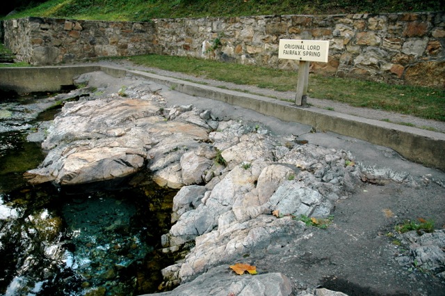
To protect them from surface pollution, two of the major springs have been enclosed. Others seep through to stone pools along the west side of the park, a natural setting similar to that enjoyed by native tribes and colonial visitors.
In myriad writings about the waters, they are uniformly described as clear and bright. Content analysis shows carbonates, sulphates and nitrates predominate among the minerals of the water, with magnesium carbonate the most abundant. These minerals give the water its trademark alkalinity and hardness. Carbonic gases are also present, and more oxygen than in other of the principal thermal springs along the Blue Ridge.
