

Great Cacapon
Four miles down the mountain on Rt. 9 from the overlook lies the tiny hamlet of Great Cacapon. “While some historians claim that Great Cacapon was surely the site of one of Washington’s proposed chain of frontier forts during the French and Indian War, Washington’s own lists contradict that claim. There is no indication in his lists that there ever was any fort at Great Cacapon. Fort Maidstone, which some claim was in Great Cacapon, is described in a 1756 Washington letter as being along the Potomac between the mouth of Sleepy Creek and Warm Springs Run. Although Isaac Dawson, who owned the land which now includes the site of today’s town, almost certainly had a fortified house on the site, there is no indication by Washington that this structure was considered a fort or that any troops were ever stationed here.”
Click image for pdf of interpretive sign.
Washington records stopping at “Great Cacapehon” during his original surveying trip of this area in 1748, and surveyed in the area in 1750 and 51. The town sits along the Potomac River just upstream from its juncture with the Cacapon River. Artifacts of a Native American town have been found along the Potomac in this area. In addition, noted 19th century historian, Samuel Kercheval reports two incursions by Native Americans in 1758 where settlers in the region were captured.
Washington owned prized Potomac riverfront land nearby and mentioned it in his diaries as one of his motives for visiting often. He was particularly impressed with the lush black walnut growth on the 240-acre tract which he valued in his will at $3600. Today, Washington’s acreage is inaccessible except by river and is in private hands.
“…to a tract of mine on the Virginia side which I find exceedingly rich, and must be valuable the lower end of the land is rich white oak in places springey; and in the winter wet. The upper part is exceedingly rich and covered with walnut of considerable size many of them. I requested a Mr. McCraken at whose house I fed my horses, and got a snack, and whose land joins mine — to offer mine to any who might apply for 10 pounds the first year, 15 pounds the next, and 25 pounds the third –the tenant not to remove any of the walnut timber from off the land; or split it into rails; as I should reserve that for my own use.”
Washington Diary, September 8, 1784
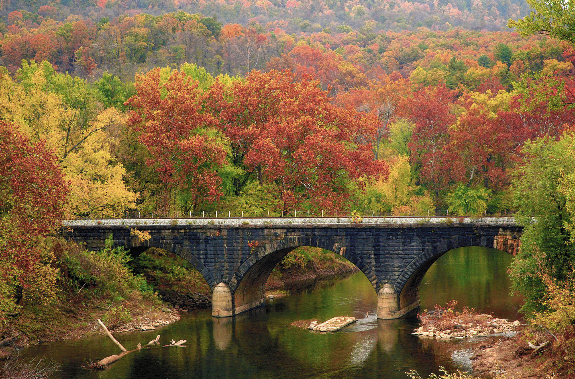
Washington described the land in his will: “It lyes on Potomac River about 12 miles above the Town of Bath (or Warm Springs) and is in the shape of a horseshoe; the river running almost around it.” His interest in this land that are part of the Paw Paw bends is described: “Two hundred acres of it is rich grounds; with a great abundance of the largest and finest walnut trees; which with the produce of the soil, might (by means of the improved navigation of the Potomac) be brought to a shipping port with more ease, and at a smaller expence, than that which is transported 30 miles only by land.” His nephew Samuel Washington bought this land from Washington’s estate for $4999. Attractions in Great Cacapon include a sportsman access to the wild and scenic Cacapon River just before entering town. A scenic railroad bridge over the Cacapon River is also visible from the road. The Cacapon River is a prime ecotourism site for Morgan County.
The juncture of the Cacapon and Potomac rivers, along with the town, are part of the view from Panorama Overlook (see previous entry).
Rt. 9’s path west along the winding, bending Cacapon River for nearly 20 miles from Great Cacapon to Paw Paw is among the most scenic roads in the state. Three river access points are available and marked.